
September 10, 2026
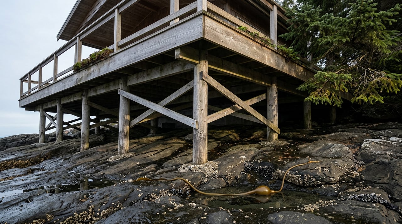
Twice a day, Kachemak Bay pulls back far enough to expose a different town. Rocks that were underwater an hour ago surface with barnacles clamped shut, waiting. Clams squirt thin jets of water as they sense footsteps. Somewhere along the bluffs west of Bishop's Beach, black chunks the size of a fist sit half buried in the sand, and if you've lived in Homer long enough, you know exactly what they are and what to do with them.
Most visitors treat the beach as a single, static thing: a place with sand, water, and a view of the Kenai Mountains. People who actually live here treat it as a schedule. The bay's tidal range runs close to 25 feet, among the largest swings in North America, and that number is not a trivia fact. It is the reason locals plan beach mornings around a tide table instead of a sunrise.
The Alaska Department of Fish and Game's own guidance for Bishop's Beach gets specific about this: go on a day when the tide drops to minus one foot or lower, and start exploring a half hour before the predicted low. Wait for the tide to bottom out and you've already missed the best window, because the water starts climbing back before the number on the chart says it should.
That timing detail matters more here than in most coastal towns, because the return isn't gentle. A 25-foot tide doesn't creep in, it arrives, and the same guidance warns that the returning water can rise faster than a person expects. Anyone who has watched a low-tide crowd suddenly cut a beach walk short and jog back toward the bluff has seen this play out in real time.
The practical version of this local habit is simple. Before deciding what to do with a free morning, check the NOAA tide predictions for the Coal Point station, the benchmark gauge that covers Homer's stretch of Kachemak Bay. A minus tide on the calendar reorganizes the day. A day without one gets spent somewhere else.
The name Coal Point isn't decoration. It traces back to a Russian survey published in 1881 by Captain Mikhail Tebenkov, who recorded the cape as Mys Ugolnoy, later translated by American surveyors as "coal cape." The name stuck because the coal was real. In 1899, the Cook Inlet Coal Fields Company began developing a coalfield within three miles of the base of the Homer Spit, and about 150 men built twenty structures at Coal Point to support what would become the original village of Homer. A narrow-gauge railroad ran the length of the spit from Coal Point to the mainland, climbed the bluff, and continued to a mining camp between Cooper and Coal creeks, where crews under British mining engineer John Kirsopp drove three tunnels into a coal seam over six feet thick.
The operation didn't last. During the winter of 1901 into 1902, the mail steamer Discovery ran on coal supplied straight from the mine, but by spring the company had shut the works down and never reinvested. What's left is geology that never got the memo: the same seams that drew a Russian surveyor's attention and a coal company's money in 1899 still sit in the bluffs along this coast, and pieces still work loose and wash up on the beach with the tide. That's why Fish and Game's list of what people actually do at Bishop's Beach includes tide-pooling and dog walking right alongside gathering coal. It's not a novelty. Locals who burn wood stoves have picked up beach coal for fuel for generations, and the City of Homer's page on Coal Point still tells the mining history to anyone curious enough to read the interpretive sign out at the point.
Homer actually offers two distinct low-tide mornings, and which one you pick depends on what you're after.
| Bishop's Beach | Diamond Creek Trail | |
|---|---|---|
| Distance from town | Walkable from Old Town | About 4 miles north via Sterling Highway |
| Getting there | End of Beluga Place, or the Beluga Slough Trail from the Islands and Ocean Visitor Center | Trailhead across from Diamond Ridge Road, 2-mile descent through forest |
| What the tide reveals | Sand-and-mud flats, mussel beds, burrowing anemones, coal in the rocks to the west | Sea stars, anemones, crabs, barnacles, open beach toward Cook Inlet |
| Best paired with | Pratt Museum's nature trail, summer art along the way | A quieter stretch, roughly 15 miles from both Anchor River and Bishop's Beach |
The in-town option starts at the Alaska Maritime National Wildlife Refuge's Islands and Ocean Visitor Center. From there, the Beluga Slough Trail is about a fifteen-minute walk on gravel paths and boardwalks through a salt marsh where Sandhill cranes and sandpipers work the mud, with wild lupine and fireweed lining the route down to the beach. Keep walking past the sand and you're in range of the Pratt Museum's own short trail network, open year-round, which hosts an outdoor art exhibit called Facing the Elements through the summer months. It's a loop that turns one low tide into three stops without ever getting in a car.
Diamond Creek asks for more effort and gives back a quieter beach. The trailhead sits across from Diamond Ridge Road, and the path down is genuinely steep in its last half, with patches of blue clay that get slick after rain, so a walking stick earns its keep. What's waiting at the bottom is a stretch of Cook Inlet coastline roughly equidistant, about 15 miles each way, from Bishop's Beach and the mouth of the Anchor River, meaning you're standing in a spot most day-trippers never reach. The tidepools here hold sea stars, crabs, and thick beds of barnacles, and it's common enough to spot otters and eagles that most regulars stop mentioning it out loud.
If you can't remember the last time you checked a tide table, you probably haven't been to the beach in a while.
That's less a joke than a genuine measure of how embedded this rhythm becomes. People who've been here a few years stop thinking of "going to the beach" as a decision and start thinking of it as something the calendar occasionally allows.
None of this requires much gear or planning, just the habit of checking one number before deciding how to spend a morning.
The tide doesn't care what day of the week it is, which is part of what makes this a genuinely local habit rather than a tourist errand. Visitors plan around ferry schedules and charter departures. People who live here plan around a chart that updates twice a day and rewards the ones who bothered to look at it.
That's the small, unglamorous skill that separates a place you're passing through from a place you actually live: knowing which low tide is worth the walk, and which beach to pick once you're there.
If Homer life like this, the kind built around tide charts and coal history and a fifteen-minute walk from the visitor center, is part of why you're thinking about a home here, Valerie Buss - Kachemak Real Estate Group has spent years learning this town street by street and beach by beach. Reach out anytime you want to talk it through.
Stay up to date on the latest real estate trends.


Leading with our core standards and values we approach every decision with honesty and integrity. We take great responsibility in doing the right thing because it is the right thing to do.